FIRST WARN WEATHER DAY: Heavy rain, storms move through Kansas City area
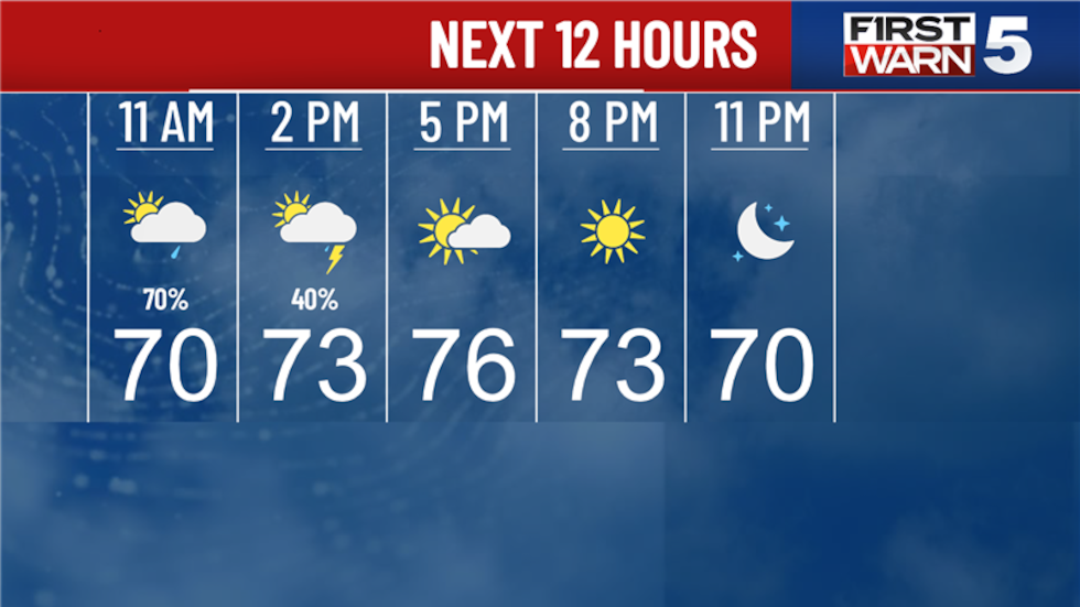
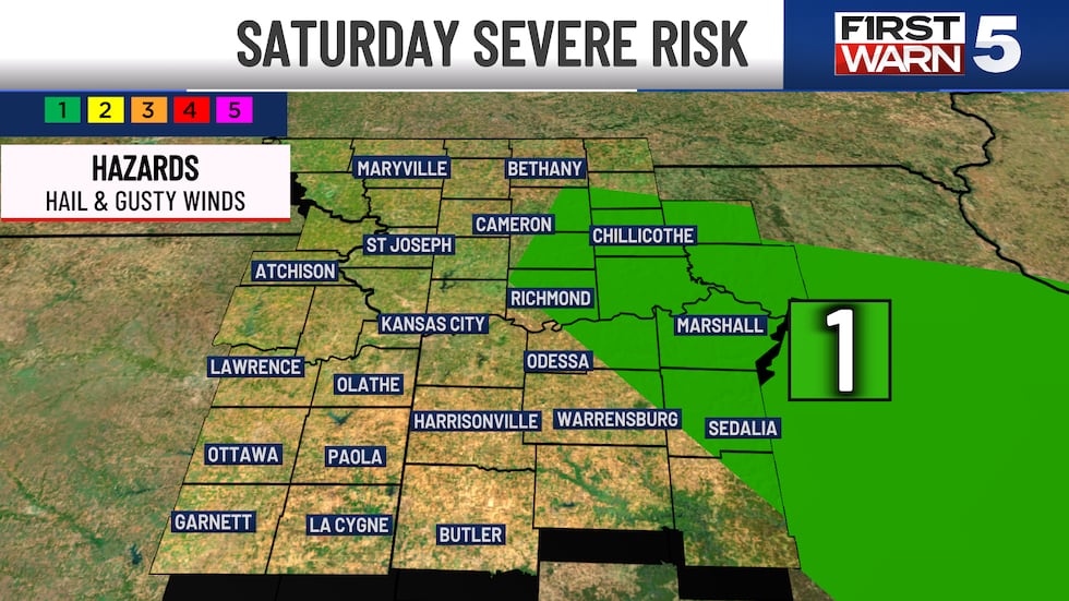
A First Warn Weather Day is in place into the early afternoon as batches of rain and thunderstorms continue and will impact outdoor plans for part of the day.
Our next push of rain and thunderstorms is dropping through the region. This looks to be spotty, but could have a few thunderstorms with heavy downpours. Those of you near and north of I-70 have the best chance for heavy rain. The latest data brings that through the KCTV coverage area now - 3 p.m.
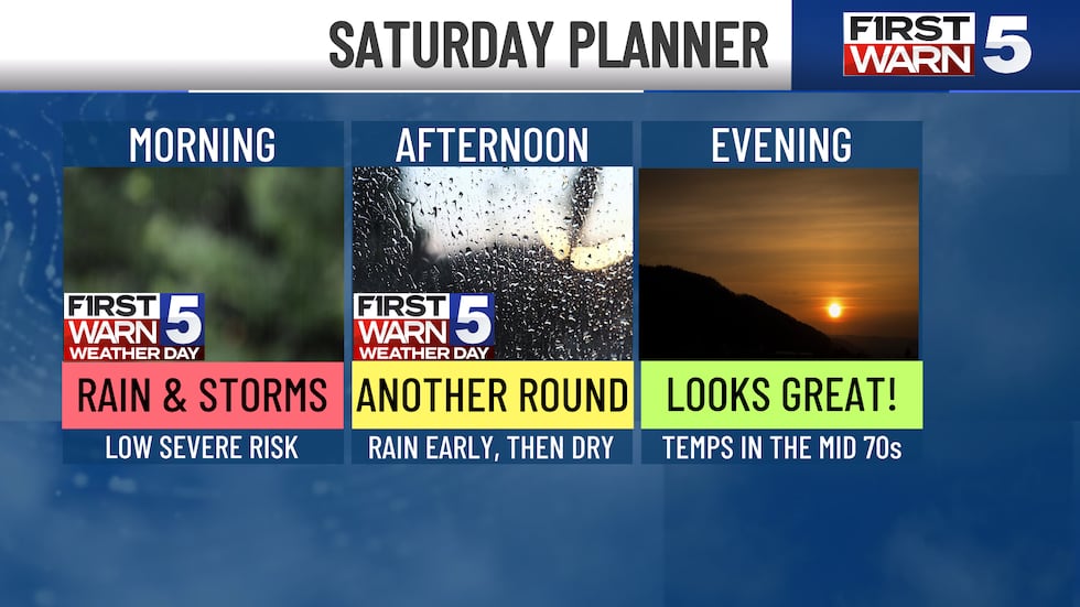
If you have outdoor plans in this timeframe, just be prepared to briefly head indoors. At this time, there is not much of a risk for severe thunderstorms. Once we clear the mid afternoon, rain chances fall off completely and temperatures will warm to the mid/upper 70s. This evening looks great!
SUNDAY:
The day starts dry with some sunshine. We should stay dry all the way into the afternoon. Our next cold front begins to drop into the region in the afternoon, likely helping spark a few showers and thunderstorms. There is a level 2/5 risk for severe thunderstorms with gusty winds and hail for those mainly near and east of I-35 prompting a First Warn. While there is a chance for thunderstorms, the window is rather short. You should be able to get outdoors for most of the day, just keep an eye on radar in the afternoon. Highs will be a bit warmer in the lower 80s.
NEXT WEEK:
Plenty of sunshine and lower 80s Monday through Wednesday. This looks like a nice stretch! We definitely will see temperatures start to climb next week. It will feel a bit more like June typically does. Thursday and Friday have spotty rain and thunderstorm chances, with a First Warn on Friday.
To get the latest weather updates sent to your phone, the First Warn 5 Weather app here.
Copyright 2025 KCTV. All rights reserved.


