FIRST WARN for wet weather at times Wednesday and Thursday
It has been a nice break in rain this afternoon and evening, but we are First Warning you that it will be a brief break. Showers will return Wednesday and Thursday, though neither day will be a washout. Still, your day may be affected at times by wet weather as our next system moves through.
TONIGHT: Temperatures will remain mild, in the 60s and upper 50s. A few showers are possible overnight, with the heaviest rain will likely remain south of Kansas City.
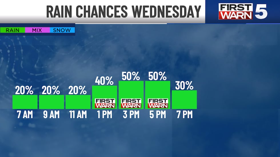
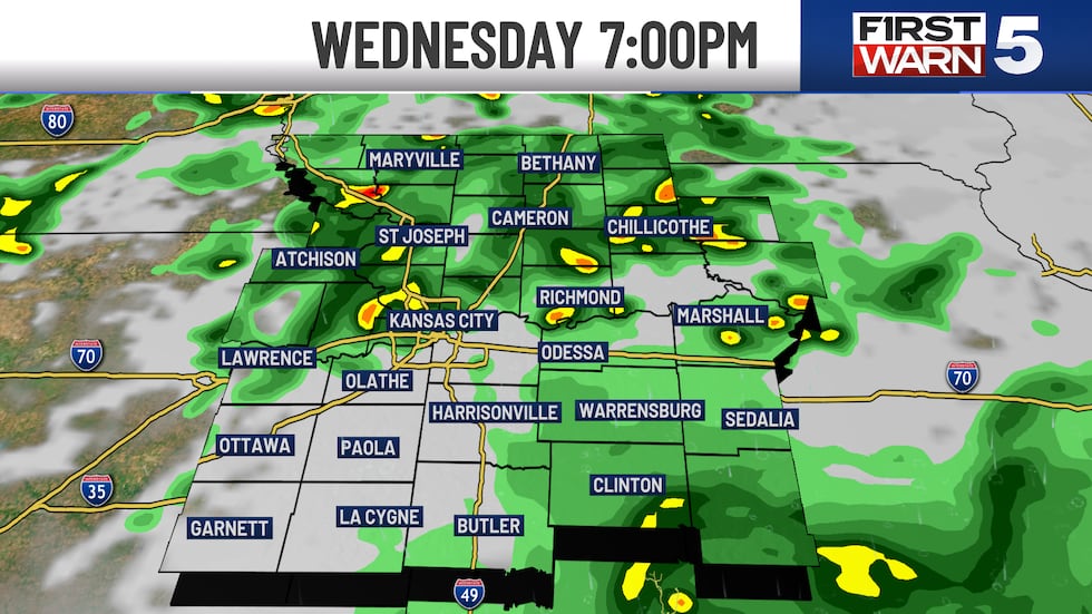
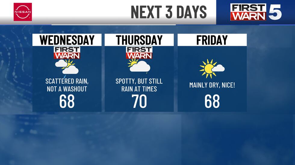
WEDNESDAY: Mainly dry morning with a stray shower possible. Dress for temperatures in the upper 50s. Active weather returns during the afternoon. We are First Warning for a 50% chance for showers from 1pm to 6pm. After school activities and early commuters may be affected. Highs reach the upper 60s.
THURSDAY: Our active pattern continues. We are First Warning for a chance of thunderstorms from morning to noon. Might see some late sunshine. Lows near 50 warm into the upper 60s.
FRIDAY: A mix of sunshine and clouds with our chance for showers dropping to only 20%.
THE WEEKEND: Best weather for outdoor weekend activities in a while. Get outside and enjoy sunshine and comfortable highs in the lower 70s and lows in the middle to upper 40s. Breezes pick up a bit Sunday afternoon.
Copyright 2025 KCTV. All rights reserved.


